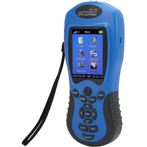
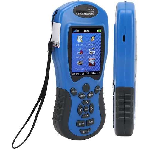
GPS land meter also known as a GPS land area measurement device or GPS land surveying tool, is a device used to accurately measure land area and boundary lines using GPS technology. GPS land meters play a crucial role in various aspects of farm management, land use planning, and precision agriculture practices.
These devices are particularly useful for land developers, farmers, and other professionals involved in land management and agriculture.
Here’s a detailed explanation of how GPS land meters are used in agriculture:
GPS land meter is used to accurately map and survey agricultural land, including field boundaries, contours, and drainage features.
Farmers can optimize field layout, plan crop rotations, and ensure efficient use of land resources using GPS.
They are often integrated with yield monitoring systems in agricultural machinery such as combine harvesters and grain carts.
They are used for crop scouting and monitoring activities, allowing farmers to assess crop health, pest infestations, and weed pressure across their fields.
GPS land meters aid in land use planning and decision-making for agriculture.
Portability:
- GPS land meters are often portable and lightweight, allowing users to easily carry them to various locations for on-site measurements.
- Some devices may be handheld, while others may be mounted on tripods or other supports for greater stability during operation.


Reviews
There are no reviews yet.